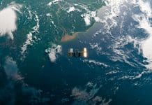
Two newly launched Copernicus missions, Sentinel-1D and Sentinel-5A, have returned their first observations, showing enhancements in Europe’s capacity to monitor the and its atmosphere
The early data from Sentinel-1D and Sentinel-5A demonstrate how the twin missions will strengthen environmental monitoring, emergency response, and global climate research.
Sentinel-1D: Detailed radar views of Northern Europe
Sentinel-1D, launched on 4 November 2025, began operations almost immediately. Just three days after liftoff, the satellite collected its first radar images, providing detailed views of northern Germany.
One of the initial scenes captures the region in false colour, revealing clear contrasts in land cover. Cultivated fields stand out distinctly from water bodies and densely built-up urban areas. Cities such as Bremen, Bremerhaven, Oldenburg, and Meldorf are easily identifiable in the imagery.
The radar view also highlights major waterways, with the Elbe and Weser rivers appearing in deep shades of blue as they wind toward the North Sea. Along the coast, the Wadden Sea’s complex patterns and tidal flats are visible, demonstrating the satellite’s capacity to track dynamic marine and coastal environments.
With its advanced radar capabilities, Sentinel-1D is set to play an important role in land and ocean monitoring. The mission will support a wide range of applications, including mapping for agriculture and forestry, tracking sea-ice movement, monitoring flooding, and assisting emergency and security services. Its ability to collect data regardless of weather or daylight conditions makes it particularly valuable for continuous environmental surveillance.
Sentinel-5A: New insights into atmospheric composition
Launched several months earlier, on 13 August 2025, Sentinel-5A has now delivered its first atmospheric measurements. By mid-October, the satellite was already producing detailed information on key trace gases, and two of its earliest products highlight global concentrations of formaldehyde (HCHO) and ozone (O₃).
The formaldehyde map reveals elevated values along Angola’s north-western coastline, an area strongly affected by wildfire emissions. Another zone of elevated concentrations lies over the Central African Republic, where both fire activity and natural biogenic sources contribute to elevated levels.
These types of measurements help scientists assess air pollution, understand atmospheric chemical processes, and detect changes linked to both human activity and natural factors.
Sentinel-5A also produced a global ozone map that illustrates the seasonal thinning of the ozone layer over Antarctica. In this region, ozone column density values drop below 220 Dobson Units, an annual phenomenon that continues to be closely monitored as part of international climate and environmental protection efforts.
Strengthening the Copernicus programme
Together, Sentinel-1D and Sentinel-5A represent a significant expansion of the European Union’s Earth-observation infrastructure. Sentinel-1D enhances all-weather, day-and-night imaging of the planet’s surface, supporting sectors that rely on rapid and reliable geospatial data.
Meanwhile, Sentinel-5A provides high-resolution insight into atmospheric chemistry, helping authorities and researchers better understand climate dynamics, track pollutants, and evaluate risks to public health.
The data collected by both missions will feed directly into Copernicus Services, ensuring that governments, researchers, industry, and the public benefit from timely, high-quality information.


