IT and business consulting services firm CGI outlines the importance of geospatial data for modern government operations, emphasising its role in enhancing decision-making across various sectors
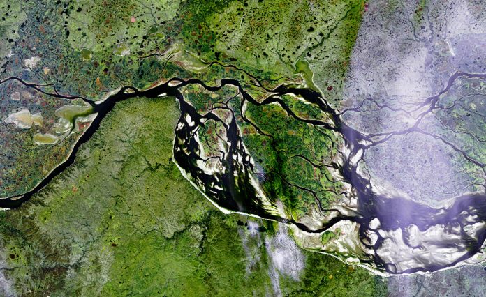
Geospatial data is a critical enabler of modern government. From environmental sustainability to transport planning, location intelligence empowers public sector organisations to make faster, smarter, and more transparent decisions.
With the UK Government committed to leveraging spatial data, as articulated in the UK Geospatial Strategy 2030, which envisions a comprehensive national location data framework by 2030, unlocking the full value of location data has never been more important to support government operations. The key missions of the strategy aim to:
- Embrace enabling technologies to accelerate geospatial innovation: This mission focuses on integrating advanced technologies such as Artificial Intelligence (AI), satellite imaging, and real-time data to drive innovation in geospatial applications. The goal is to enhance the UK’s position as a leader in geospatial technology by leveraging these emerging tools.
- Drive greater use of geospatial applications and insights across the economy: This mission aims to promote the widespread adoption of geospatial data and applications across various sectors, including property, transport, and utilities. By embedding location data into these industries, the strategy seeks to unlock significant economic benefits and improve public services.
- Build confidence in the future geospatial ecosystem: This mission is dedicated to establishing a trustworthy and robust geospatial framework. It involves setting standards, ensuring data quality, and fostering collaboration among stakeholders to create a sustainable and reliable geospatial infrastructure.
Delivering complex, mission-critical systems for nearly 50 years
At CGI, we have over four decades of experience supporting UK Government IT systems, harnessing the full potential of geospatial technology, with 500+ geospatial professionals worldwide to deliver integrated, secure and scalable solutions, connecting place, people, and purpose.
And our clients are reaping the benefits of national environmental data platforms and local land management solutions:
- Managing common land in Wales:
The 22 Welsh local authorities needed to modernise their fragmented paper records into a unified digital platform. By delivering a modern GIS-enabled registry, local planning departments, legal services, and citizens can access accurate and consistent land records with ease, reducing processing times and enhancing transparency. - Earth observation for environmental monitoring:
The DEFRA group required an Earth Observation data processing and dissemination platform to enable access to up-to-date satellite imagery for environmental policymaking, compliance monitoring, and climate impact analysis. CGI’s solution, with automated ingestion and classification of data helped Defra scale up analysis without the need for manual interpretation. - Property risk automation:
The Mining Remediation Authority needed to better understand the impact of former coal mining activities and have the ability for users to self-serve and exploit new delivery channels. Their new mining risk report service automatically assesses land stability risks during the home-buying process. Integrated into national land databases, this service provides near-instant reports to homebuyers and solicitors, improving speed and certainty in the property transaction chain. - Maritime surveillance:
The Marine Management Organisation required the ability to detect abnormal activities, enforce maritime boundaries, and support conservation efforts through real-time insights. CGI developed and deployed an AI-powered geospatial platform enabling government departments to monitor overseas coastal waters using satellite data and predictive analytics. - Modernising farm subsidy systems:
The Finnish Food Authority wanted to enhance their land parcel identification system using satellite imagery and AI and Machine Learning. By automating classification of farm land types and validating subsidy eligibility, they built a system that improves accuracy, reduces inspections, and ensures faster payments to farmers. These techniques can be adapted to support UK agricultural compliance schemes.
Throughout delivery, we support government clients across the entire geospatial value chain, ensuring our services align with emerging trends and technologies in the geospatial sector so that our clients remain at the forefront of innovation. These services and capabilities include:
- Strategy & advisory:
We work with departments to define enterprise- wide geospatial strategies aligned with organisational objectives. This includes architecture reviews, roadmap definition, and identifying high-value use cases for location data. Our advisory services are based on a strong understanding of UK public sector policy and governance environments. - Data migration and integration:
We support the migration of geospatial data from legacy platforms and fragmented systems into modern, interoperable solutions. We facilitate data federation using open standards such as INSPIRE and OGC, ensuring systems can communicate across organisational boundaries. - Application development and systems integration:
CGI builds bespoke and off-the-shelf geospatial applications for desktop, mobile, and web use. These tools are tailored to the workflows of departments – from planning and licensing to emergency response and asset tracking. We work across major geospatial platforms including ESRI, QGIS, GeoServer, Geonode and Mapstore. - Real-time geospatial analytics:
We enable live spatial insight by integrating real-time sensor data, traffic feeds, mobile signals, and IoT inputs. These systems support dynamic decision-making for use cases like congestion monitoring, environmental alerts, and real-time asset management. - AI, Machine Learning and automation:
CGI applies AI/ML models to satellite imagery, drone footage, and historical spatial data to detect change, classify land use, and predict future patterns. This supports proactive regulation and efficient resource allocation. - Cloud & Edge deployment:
We architect and deploy geospatial solutions using public, private or hybrid cloud environments. For use cases requiring low latency and offline capability (such as field inspections), we support edge deployments as well.
So, whether you’re exploring location data for the first time or scaling an enterprise GIS, CGI is your trusted partner for delivering public value through geospatial insights.
Download the white paper to learn more or contact our geospatial expert Pascal Coulon.

This work is licensed under Creative Commons Attribution-NonCommercial-NoDerivatives 4.0 International.


