William Leith, Senior Science Advisor for Earthquake and Geologic Hazards at U.S. Geological Survey (USGS) explains the important aspects of the USGS Earthquake Hazards Program
September 2018’s earthquake and tsunami disaster in Sulawesi, Indonesia, is our most recent reminder of the devastating power of large earthquakes. With a death toll exceeding 2,000 by recent estimates, this complex disaster, which included widespread ground failure that buried large parts of the city of Palu (pop. 335,000), now ranks among the worst earthquake disasters of the past 100 years.
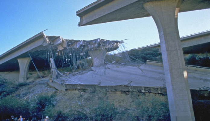
It could happen here. Although Americans have not experienced a major earthquake disaster in nearly 25 years, since the 1994 earthquake that struck Northridge, California, the Federal Emergency Management Agency (FEMA) recently estimated that, when averaged over decades, annual earthquake losses in the U.S. are $6.1 billion, with nearly half of Americans living in areas vulnerable to strong shaking in future earthquakes.
Yet earthquake losses can be reduced by improving the resilience of buildings, bridges and other structures, and by taking quick action when the ground starts shaking. Preparedness, mitigation, and informed response can reduce deaths, injuries, and economic losses from earthquakes, tsunamis, and earthquakeinduced landslides and soil liquefaction. In other words, informed and proactive communities can save both lives and money.
To help reduce losses from earthquake hazards, the USGS Earthquake Hazards Program (EHP) supports a highly coordinated set of monitoring, hazard assessment, applied research, and risk communication activities nationwide. We provide the nation with a growing suite of rapid earthquake information products, deliver regional and national seismic hazard assessments, conduct targeted research to improve these functions, and coordinate post-earthquake investigations to understand better the effect of earthquakes.
The USGS program is the applied earth-science component of the four-agency National Earthquake Hazards Reduction Program (NEHRP). Through NEHRP, the USGS partners with FEMA, the National Science Foundation, and the National Institute of Standards and Technology to reduce earthquake losses (both life and property losses) in the U.S.
Response organisations require actionable earthquake information. The EHP monitors the nation’s earthquakes via the Advanced National Seismic System (ANSS) which includes regional seismic networks operated by university partners. ANSS data, combined with data from the Global Seismographic Network, which the USGS co-supports with the National Science Foundation, is delivered in real-time to the NOAA Tsunami Warning Centers, enabling tsunami alerts throughout the Pacific Rim, including Alaska, Hawaii, Washington, California, and U.S. Territories, and in the Caribbean.
Through the National Earthquake Information Center (NEIC), we provide 24×7 reporting on domestic and global earthquakes and deliver rapid earthquake impact and situational-awareness products to support emergency response (the EHP website can often hosts more than 10 million visitors per month!). The NEIC catalogues more than 20,000 earthquakes a year, from imperceptible ones to great earthquakes that shake the whole globe. We also develop improved methods to improve the quality and timeliness of real-time earthquake information. We communicate earthquake information to the public and to key stakeholders that include federal and state emergency response agencies, disaster relief organisations, operators of utilities and lifelines, and local communities at risk.
ANSS earthquake products help governments and humanitarian groups to decide how to respond in times of crisis. Rapid situational awareness of an earthquake’s severity is used across the response spectrum: from how quickly search-and-rescue teams have to pack their bags, to whether or not a metropolitan area should shut down its mass-transit-rail system. Hundreds of key responders, from the Red Cross to the White House to the United Nations, rely on the USGS to tell them exactly how severe an earthquake is and look to our models for the scale of potential impacts.
The EHP also maintains the USGS National Seismic Hazard Model, which describes the likelihood and potential impacts of earthquakes nationwide, and which serves as the basis of seismic provisions in building codes. We deliver each model update to the Building
Seismic Safety Council, which develops building code updates, and we maintain associated databases and tools that are widely used for site-specific engineering design and seismic risk analysis.
The EHP also conducts and supports applied field, laboratory, and theoretical research on the causes, characteristics, and effects of earthquakes. Furthermore, we support relevant research by expert partners in academia, state agencies, and the private sector via competitive grants and cooperative agreements.
The latest development in earthquake safety is earthquake early warning (EEW). By recording an earthquake near its origin, one can quickly estimate its size and broadcast a warning ahead of the quake’s strong ground shaking. The USGS and our university partners have built and are now testing an EEW system for the U.S. West Coast, called “ShakeAlertTM”, which will begin initial alerting in the next few months. Similar systems in Japan, Taiwan, Mexico, and elsewhere have proven the utility of early warnings and demonstrated that there is demand for these alerts.
So, if you live in California, Oregon and Washington or have family and friends there, or even plan to visit, in the near future you will be seeing EEW apps that receive USGS ShakeAlerts. Then, when an alert arrives, duck, cover and hold on!
William Leith
Senior Science Advisor
Earthquake and Geologic Hazards
U.S. Geological Survey (USGS)
Tel: +1 703 648 6786
wleith@usgs.gov
www.usgs.gov
www.twitter.com/usgs


