
Instrumented aircraft are an important scientific tool, allowing researchers to support a range of applications in environmental sciences, says EUFAR
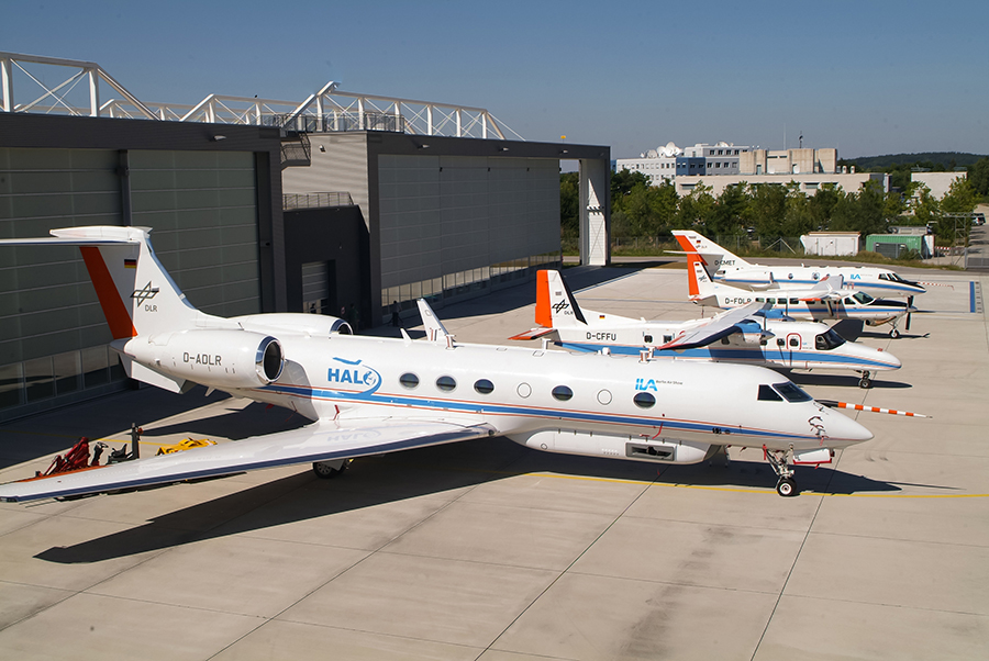
EUFAR is currently supported by the 7th Framework Programme (FP7) of the European Commission. It combines 24 European institutions and organisations involved in airborne research, operating 19 instrumented aircraft and 5 remote-sensing instruments, providing a broad measurement capability.
There is a long history of airborne observational research contributing towards incremental developments in the scientific understanding of Earth-system processes. These developments have proceeded in parallel with similar developments in the capabilities to observe these processes on a global scale from space and to model them in operational Numerical Weather Prediction (NWP), Climate and Earth-System Models. The fields of science that are impacted by an airborne research observing capability are very broad and span the atmosphere, ocean, land surface and biological systems. Maintaining access to a broad range of airborne observing facilities is critically important to our future ability to study processes in the environment and to develop and use the models that will, for example, be used to study mitigation strategies in a changing climate.
EUFAR aims to:
- develop transnational access to national facilities;
- improve the quality of the services provided by aircraft and instrument operators by strengthening expertise through knowledge exchange;
- develop and maintain a central database of airborne data and the standards for this database to be interoperable with other environmental science and Earth observation databases;
- support joint instrumental research activities centred on the development of improved data processing and calibration techniques;
- promote the use of research aircraft and instruments by providing education and training courses on airborne research topics;
- support innovation in airborne research, working with industry to transform airborne research instruments, methodologies and software into new products and services.
EUFAR activities
- i) Transnational access
Transnational Access provides fully-funded flight time to Principal Investigators and User Groups without access to the required airborne observing facilities via national funding within their country of employment. To maximise the scientific impact, applications are encouraged that can be clustered with larger nationally- or internationally-supported flight campaigns. 32 projects have been approved for funding, evenly split between the use of in-situ atmospheric measurements and the use of imaging systems for Earth Observation. As a result of clustering, TA flight activities have been possible in West Africa as part of the multi-national DACCIWA campaign, in the Cape Verde Islands and also in Namibia.
- ii) Networking activities
EUFAR supports a number of Networking Activities that share its objectives of improving efficiency and spreading best practice in airborne research observations.
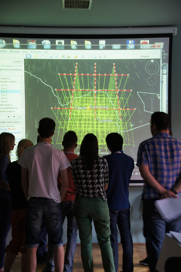
Education and Training are designed to attract and train both early-stage researchers and university lecturers in airborne atmospheric research observations and remote sensing of the Earth surface and to develop/consolidate EUFAR training course educational material. By the end of its present contract, EUFAR will have supported a further four summer schools on airborne research topics hosting approximately 80 students.
Standards and protocols aim to harmonise and document processes in the management of data within EUFAR, including both in-situ and Earth observation data. A focus has been on the update and extension of previously-developed common protocols and standards and assuring their compatibility with international standards. EUFAR is engaging with the ENVRIplus community of research infrastructures via the implementation of its data Reference Model. This promotes interoperability and will put access to airborne data on the same footing as that from other infrastructures.
A database ensures that valuable data, metadata and documentation are widely available to facilitate data discovery, exchange, collaboration and re-use. The archive is maintained by the Centre for Environmental Data Analysis (CEDA) in the UK and is accessible via the EUFAR website.
iii) Joint Research Activities (JRA)
Two JRAs are currently being undertaken, both aiming to improve the quality of airborne data and developing new data products and services supplied to scientific users.
HYLIGHT is working to develop, test and validate improved software tools for the combined use of Hyperspectral Image (HSI) and Airborne Laser Scanning (ALS) data and improved ALS data processing using HSI and to make them freely available. These tools will, for example, contribute to better management of forest ecosystems for both recreational and economic purposes, where the combined measurements yield more detailed information on the nature of the forest canopy. HYLIGHT tools, installation guides and user manuals can be downloaded from the EUFAR website
TGOE is working to develop robust calibration systems for gas-phase chemical measurements made on board research aircraft.
These contribute substantially to the development of numerical models used for both air-quality forecasting and longer-term climate studies, providing information on the vertical distribution of species that are difficult to obtain by other means. They are also an important source of local and regional validation for satellite observations that are used for global-scale measurements. Studies of trace gas emissions and evolution often involve one or more aircraft together with fixed, ground-based measurements. Working with the IAGOS and ACTRIS communities to develop the best calibration techniques, TGOE seeks to reduce measurement uncertainties and so enable them to be used to provide more detailed analyses of the processes involved in the transport and chemical evolution of atmospheric trace gases.
The future of EUFAR
EUFAR is seeking to establish itself as an AISBL (international non-profit association). Such an association, supported by members’ cash and in-kind contributions will ensure that key EUFAR activities can continue beyond its present funding by the European Commission. These activities will include the maintenance of its website and broadening access both to the aircraft themselves and to data obtained from flight campaigns. EUFAR is also currently seeking Expressions of Interest in future Joint Research Activities that may be undertaken within the framework of the AISBL
Significant progress has been made by a core group of members to form such an association. Agreements will enable as wide a range of organisations as possible to participate in its work, as members or partners, hence broadening its impact in countries not presently operating their own research aircraft. The AISBL will be formally established at the start of 2018.
Philip R A Brown
EUFAR Scientific and Transnational
Access Coordinator
Met Office
Tel: +44 (0)1392 886740
phil.brown@metoffice.gov.uk, bureau@eufar.net
Please note: this is a commercial profile


