
Gwo-shyh Song discusses one of the sub-projects of the Taiwan Earthquakes Center to conduct a high-resolution seabed geophysical survey around Taiwan offshore areas
The main purpose is to outline seaward extension of the active faults that have been shown on land and then to capture its tectonic behaviour and its occupation in offshore territory. Survey tools are using multi-beam echo sounder, side-scan sonar and 3.5 kHz sub-bottom profiler.
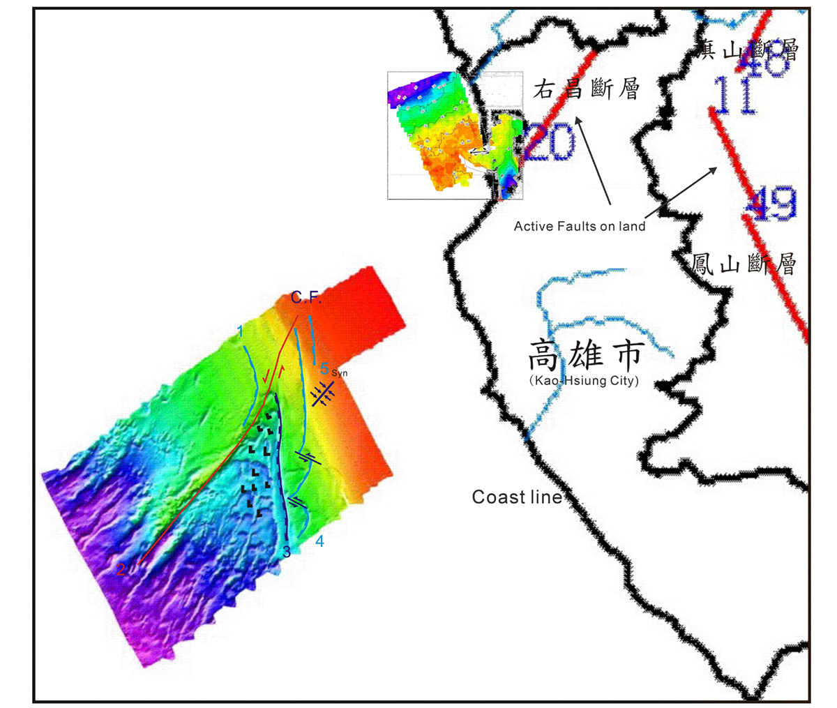
This report investigated the Chi-San Fault situated in the Kaohsiung area. Bathymetrical data has indicated that fracture of seabed was caused by left lateral fault motion and this motion brought subsidence of the seabed to its southern region. Subsidence comes from the motions of a series of normal faults with their direction conjugated with the direction of left lateral strike-slip fault.
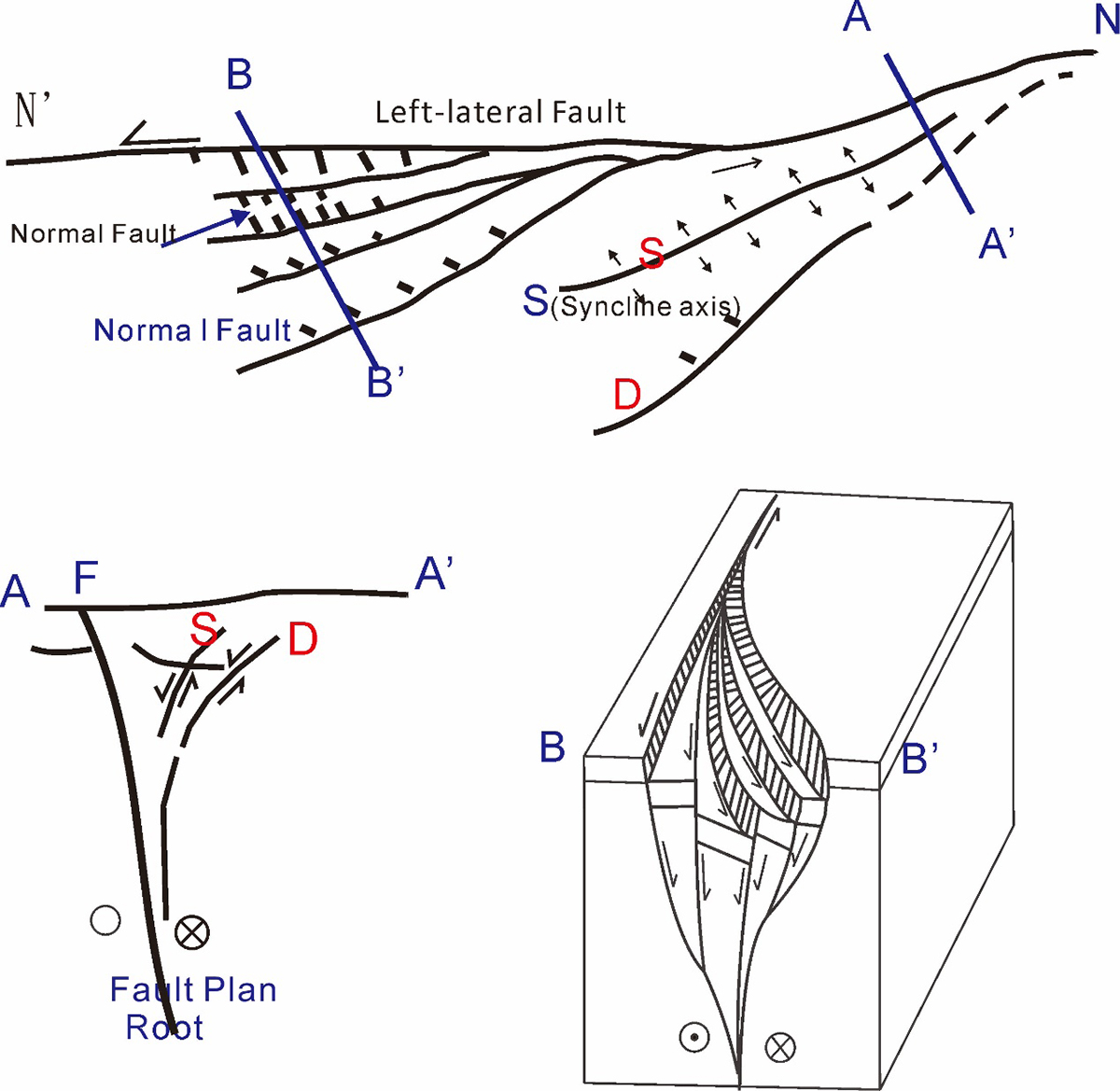
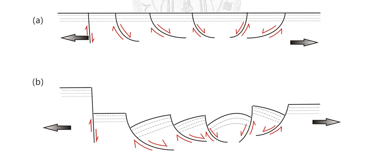
The underwater topography and seismic profiles imply there is a left-lateral strike-slip fault activity shown in offshore area. The seabed showing subsidence shall be along the fault line and this depression was caused by the normal fault group that is nearly perpendicular or conjugated to the strike-slip fault. This series of normal faults had been cut off by the strike-slip fault to represent it as a newer tectonic line.
It is believed that the force of the left-lateral motion comes from the island side of Taiwan, which is also related to the orogeny of Taiwan; because of the orogeny, the survey area belongs to the southern section of the orogenic belt and its north is affected by the main stress of the east-west compression, and thus rebounds. In other words, due to the stronger compression force coming from the northeast, after a fault surface generated with its strike in east-west direction, the earth block on the south side of the fault surface shall moves eastward relative to the north block. As a result, this fault surface forms a left-lateral strike-slip fault causing the seabed on the south side was rebound to the east, resulting in the spalling of the surface seabed formation.
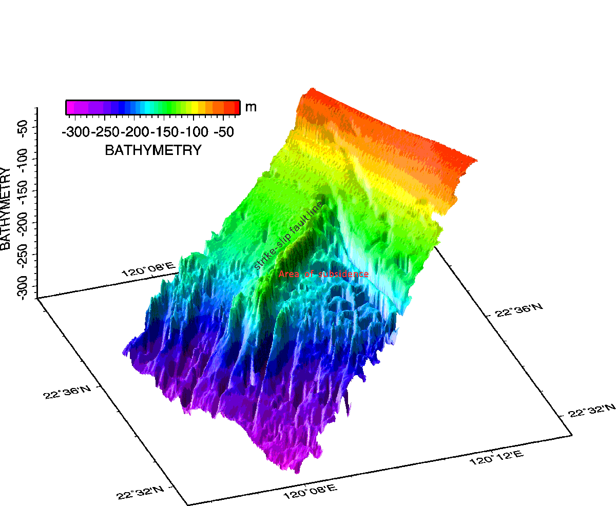
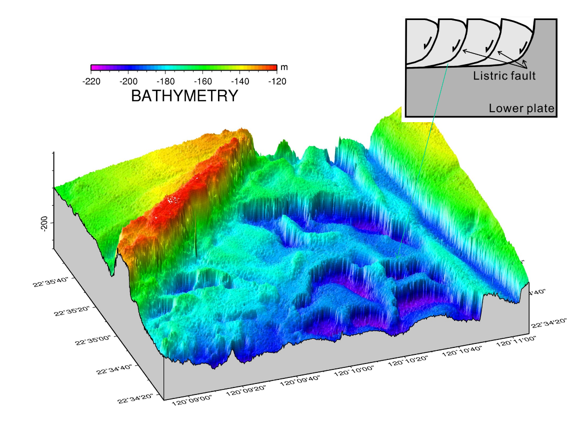
Fault No 2 (called CF on the diagram) belongs to block boundary mentioned as the left-lateral strike-slip fault. Its end is located at the northwest end of the subsidence triangle due to the pull of the translational movement, a linear subsidence area appears at its tail end. Furthermore, along this fault line to the land direction, it most probably connects to the active fault shown on the land. In addition, on the seabed of the offshore terrace area, in which water depth is less than 50 metres, the fault is covered by recent sediments and the sediments above it do not show traces of misalignment, indicating that the fault movement may become less effective.
The seabed environment had been always stable without disturbing from human activity, such that the traces of tectonic activity are easy to retain. The plan proposes to observe the linear type of the suspicious fault structure line extending to the sea as an easy way to detect whether the fault has activities. On the topographic map offshore the coastline to the west side of the Chi-San Fault, its extension and a topographical linear connection can be easily seen. Therefore, once we can produce a clear acoustic image of the seabed when we observe the tectonic lines that cannot be identified or confirmed on land, we may grasp the scope and tectonic pattern of the land structure of which extending to the seafloor.
Please note: This is a commercial profile
© 2019. This work is licensed under CC-BY-NC-ND.


