
Using magnetotellurics, the EARTH project will generate models predicting magma flows and solar storms to forecast risks to the energy industry
A five-year project titled ‘Electromagnetic Array Research over a Tectonic Hotspot’ or EARTH, has been awarded £1,032,422 for assessing the risks of magma flows and solar storms on an energy cable proposed between Iceland the UK.
Dr Fiona Simpson, the lead of the project, said: “Hundreds of millions of people’s lives globally are impacted by volcanic activity. If we can understand what drives eruptions, by mapping magma flows below Earth’s surface, we can be better prepared to deal with the consequences.”
Seismological models and magma flows in Iceland
Iceland sits on a line of subsea volcanoes where magma flows are upwelling as two tectonic plates pull apart, known as the mid-Atlantic ridge.
The eruption of the Eyjafjallajökull volcano in 2010 grounded flights across Europe and caused mass disruption to energy supplies. To tackle this, Dr. Simpson’s research modelling the origins of Iceland’s volcanism using existing seismological data will help governments and communities plan for and mitigate volcanic events.
Iceland is far larger than any other volcanic area on the ridge, which led scientists to explore the hot material from the mantle underlying the Icelandic ‘hotspot’ – to which, the source of this plume is not well known by current seismological (earthquake) data.
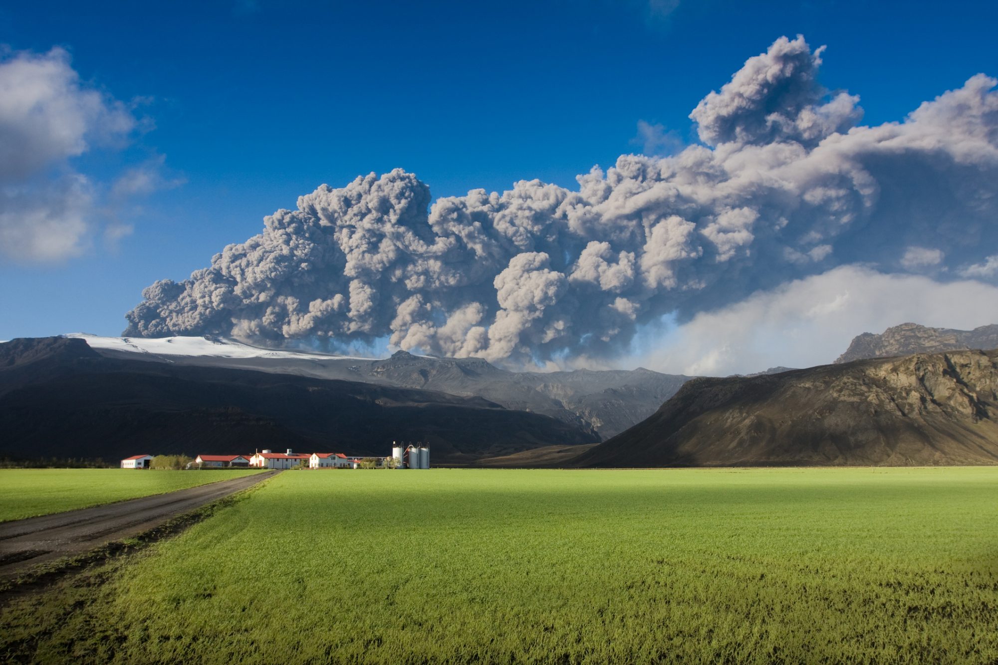
Image © sumos | iStock
Some argue Iceland’s plume may not exist at all
Current seismological models note that the plume may rise from below Greenland rather than Iceland, given the topography at the underside of the North American tectonic plate towards Iceland, believed to extend below the plate as far as the British Isles.
Dr Simpson’s work will take these magnetotelluric measurements across Scotland, Iceland and Greenland to characterise the mantle and the plume to understand the risky areas and where they derive from.
Understanding magnetotellurics
Magnetotellurics use natural electric and magnetic fields induced in the Earth by interactions between the solar wind (a stream of high-energy charged particles from the Sun) and Earth’s magnetosphere (a protective shield around the Earth maintained by Earth’s magnetic field) to characterise electrical conductivity as it varies in the deep Earth.
The use of seismological, magnetotellurics and chemical data from lavas helps to solve controversies about the nature of the Iceland hotspot that cannot be addressed using a single geophysical method.
Estimates of electric fields during geomagnetic storms
Extreme space weather events, such as solar flares and coronal mass ejections, can cause ‘geomagnetic storms’ on Earth, which can induce dangerous currents in power transmission cables and result in blackouts.
Other than her research on Iceland’s magma flows, this data is going to help determine the risk from space weather to a proposed 1000km high-voltage cable for transferring energy from Iceland to the UK.
Regarding how much current is in these cables depends on the electrical conductivity structure of the deep Earth, which is what Dr Simpson’s measurements will characterise to deliver predictions of electric fields during geomagnetic storms.
This data will also deliver worst-case-scenario space weather hazard maps, and the occurence and severity of such events occurring, giving the energy industry a basis for contingency planning.
Finally, all this data on magma flows and solar storms will contribute to the UK’s net zero energy plans, by delivering sustainable, geothermally generated, low carbon energy from Iceland amidst the new Atlantic Superconnection.


 while also saving energy")


