
The Rwanda Space Agency has partnered with the Research Institute for Innovation and Sustainability to transform the space innovation ecosystem
There is clear evidence that countries with developed space innovation ecosystems and programmes enjoy advanced socio-economic development, argue Imraan Saloojee and Louis Moussi from the Research Institute for Innovation and Sustainability (RIIS).
As the applications of space technologies multiply, so do the derived impacts and benefits. These include a positive impacts on GDP through employment and revenue gains; diverse economic, technological and scientific excellence; and innovation in key sectors such as agriculture and energy.
Rwanda is set to be a leading African nation in harnessing emerging space opportunities to support the country’s socio-economic development goals. The Rwanda Space Agency (RSA) has partnered with The Research Institute for Innovation and Sustainability (RIIS) to transform Rwanda’s nascent space innovation ecosystem into a robust and vibrant one.
The Rwanda Space Innovation Ecosystem Review, funded by the United Kingdom Foreign Commonwealth and Development Office (UKFCDO) under the Research Innovations Systems Africa (RISA) Fund, seeks to foster a vibrant space innovation ecosystem in Rwanda, and to support is growth and advancement.
The African space sector finds itself at a very exciting phase of its growth. Several space agencies have been established across the continent, which speaks to a greater awareness and recognition from policymakers of the opportunities that space and space-based technologies can provide.
As well as its ability to solve a wide range of developmental challenges, including climate change, and play a role in disaster management, development and food security.
Satellite navigation technologies and earth observation data, now more readily accessible, are further driving the development of innovative new businesses.
Climate adaptation and mitigation strategies
Climate change is one of the most pressing issues of our time, and its effects are being felt around the world. Satellites combined with Artificial Intelligence (AI) can provide valuable insights into Earth’s changing climate, helping facilitate climate adaptation and mitigation strategies.
Space technology has a wide range of potential applications in understanding climate change. For example, satellites can be used to monitor forest fires, ensuring that they don’t spread out of control.
They can also be used for food security and health monitoring, as well as GHG emission monitoring/carbon accounting. Additionally, space technology can help build resilience in disaster risk management, desertification and deforestation monitoring, biodiversity loss monitoring, drought warning systems, and flood warning systems.
In Rwanda, space technology is being used to monitor crop growth patterns in order to better manage food production levels.
This data helps inform decisions about how much food should be produced in order to meet demand while avoiding overproduction or shortages. Additionally, satellite imagery is being used to track deforestation levels in order to protect wildlife habitats and ensure sustainable land use practices.
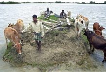
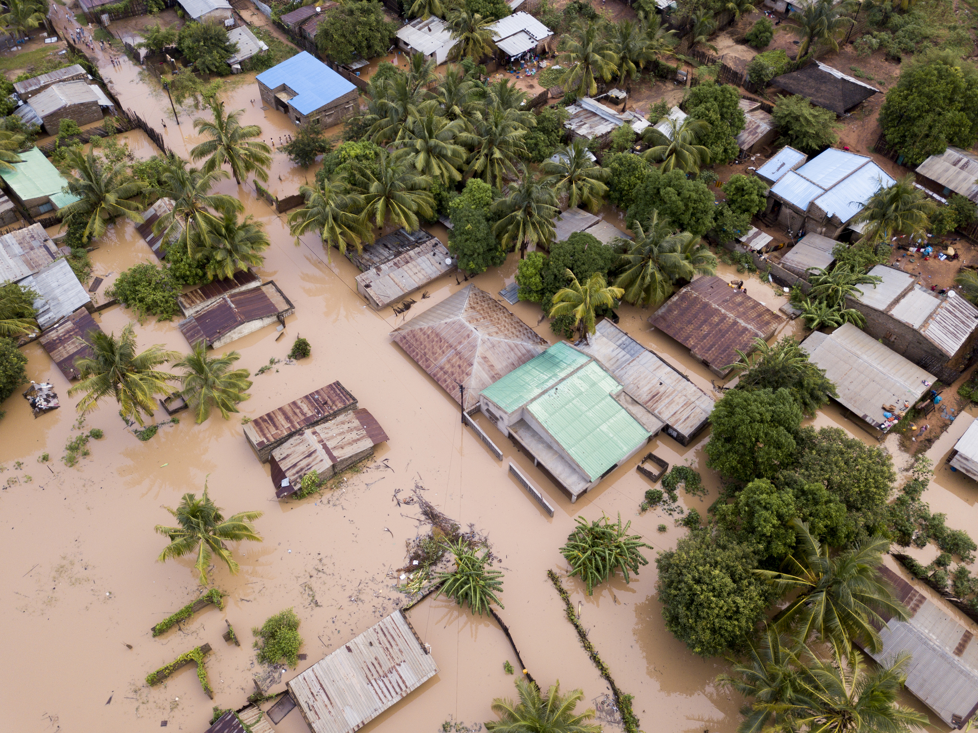
Disaster management in Rwanda
Rwanda has been affected by both natural and human-induced disasters. The use of space technology in disaster risk management can help the country to better prepare for, respond to, and recover from these disasters.
This includes providing early warning systems, monitoring recovery and rehabilitation processes, and mapping population vulnerability and exposure. Space-based data can also be used to assess disaster risks, forecast weather and hazards, and detect near real-time hazards.
Sustainable urban and rural development
The effective application of space technology and data in sustainable urban and rural development is crucial for evidence-based decision-making in Rwanda.
Space-based data not only supports informed planning and monitoring but also offers significant cost and time savings, especially in areas where data collection is challenging.
Potential application areas include traffic monitoring, which helps optimise transportation systems, reduce congestion, and minimise pollution.
It can also be used to monitor air and water quality, enabling authorities to take timely action in addressing environmental challenges and ensuring public health.
In urban and rural planning, satellite imagery plays a vital role in identifying land use patterns, monitoring urban sprawl, and guiding infrastructure development. This information helps ensure that the growth of cities and towns is sustainable and aligned with the country’s development goals.
Disaster management is another critical area where space-based data can make a significant impact. It allows for early warning systems, risk assessments, and monitoring of recovery and rehabilitation processes, contributing to more resilient communities.
Land and marine monitoring is essential for preserving ecosystems, managing natural resources, and supporting sustainable agriculture. By utilizing space-based data, Rwanda can effectively monitor deforestation, soil degradation, and other environmental threats.
Infrastructure monitoring and the development of smart infrastructure are also possible through the use of satellite data. This enables efficient maintenance, resource allocation, and improved service delivery, leading to more sustainable communities.
Drone delivery systems, supported by space-based data, can revolutionize logistics and supply chain management in Rwanda. These systems have the potential to enhance access to essential goods, particularly in remote and underserved areas.
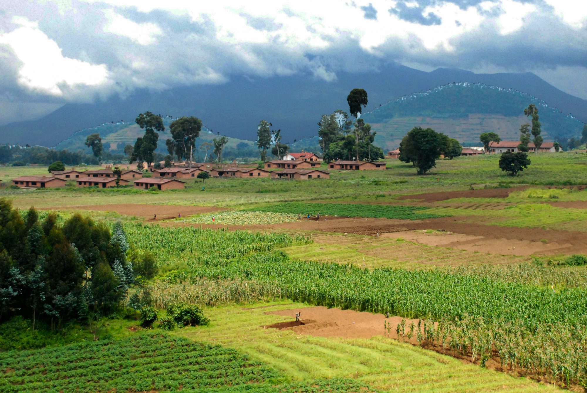
Food security and agriculture in the space innovation ecosystem
Space plays a crucial role in ensuring food security, safety, and sustainability in Rwanda. By leveraging space-based data, the country can adopt modern land management practices, such as soil conservation, crop diversification, and pest or disease management, leading to increased agricultural productivity and improved food security.
Space-based data can Increase agricultural productivity and improved food security
In agricultural planning, satellite imagery can help identify optimal areas for cultivation, assess crop yield potential, and monitor land use changes. This information is vital for making informed decisions on resource allocation and agricultural policies.
By using satellite imagery and remote sensing technology for precision agriculture, farmers can optimise the use of resources such as water, fertilizers, and pesticides, facilitating increased crop yields and reduced environmental impact.
Crop health detection is essential for early identification of pests, diseases, and nutrient deficiencies. By harnessing space-based data, authorities and farmers can take timely action to address these issues and minimize crop losses.
Soil type mapping allows for gathering information soil properties and nutrient availability
Land and marine monitoring, along with forecasting weather and crop hazards, helps farmers and policymakers make informed decisions on planting, harvesting, and resource management. Accurate weather forecasts also support water resource management, enabling efficient irrigation practices and reducing the risk of drought-related crop failures.
Soil type mapping allows for better understanding of soil properties and nutrient availability, which is essential for sustainable agriculture.
By using space-based data, farmers can tailor their agricultural practices to suit the specific needs of their land, resulting in higher crop yields and improved soil health.
A notable project underway in Rwanda is the collaboration between the Rwandan Ministry of Agriculture and Animal Resources and the Japan International Cooperation Agency (JICA). This project uses satellite-based remote sensing technology to monitor crop health, estimate yields, and provide early warning of potential crop hazards.
Fishery sustainability is another critical aspect of food security. Satellite data can be used to monitor fish populations, track illegal fishing activities, and ensure the long-term sustainability of marine ecosystems.
Satellite navigation systems and Earth observation data
Satellite navigation (satnav) systems have become indispensable tools for providing precise location and timing services.
When combined with Earth observation data, these systems can offer deeper insights and enable more informed decision-making across various sectors in Rwanda.
Businesses like Charis UAS, a drone service provider, are already using satellite navigation systems and Earth observation data to support various sectors, including agriculture, land surveying, and infrastructure monitoring.
One of the most significant application areas is precision agriculture. Farmers can use satnav systems to direct their field equipment with great accuracy, optimizing the use of resources such as water, fertilizers, and pesticides.
This results in increased crop yields, reduced environmental impact, and improved food security.
Maritime and air traffic management can also benefit from the combination of satnav systems and Earth observation data. By tracking the position of ships and aircraft, authorities can ensure efficient routing and enhance safety while reducing the risk of accidents and congestion.
Improving road safety and reduce traffic congestion with GPS tracking systems
The Rwandan Ministry of Infrastructure is using GPS tracking systems to monitor the movement of vehicles in order to improve road safety and reduce traffic congestion.
Emergency and location-based services are another critical application area. Satnav systems can help emergency responders quickly locate and reach people in distress, while Earth observation data can provide essential information on terrain, weather conditions, and potential hazards, improving the efficiency and effectiveness of rescue operations.
Satellite communications and land surveying can also benefit from the integration of satnav systems and Earth observation data.
This combination allows for more accurate positioning and mapping of infrastructure, natural resources, and land boundaries, supporting sustainable development and resource management.
Vehicle fleet management is an essential aspect of modern logistics
By using satnav systems in conjunction with Earth observation data, businesses can optimize their operations, reduce fuel consumption, and minimize environmental impact.
Wetland mapping is another area where satellite navigation systems can play a vital role. By providing accurate location data, these systems can help monitor the health and extent of wetlands, supporting conservation efforts and informing sustainable land-use decisions.
It’s clear that space technology and data holds immense potential for enhancing decision-making across various sectors in Rwanda.
By creating an environment and the implementing the right interventions to encourage the development and application of these technologies, the country can drive economic growth, ensure sustainable development, and create a better future for its citizens.
This is the ultimate goal of developing a strong space innovation ecosystem.
This piece was written and provided by Imraan Saloojee and Louis Moussi, Research Institute for Innovation and Sustainability (RIIS).