
Leigh Orf discusses his research team’s recent breakthrough thunderstorm simulations at the University of Wisconsin–Madison Space Science and Engineering Center (SSEC)
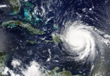
The United States Great Plains are a hotspot for the world’s most powerful thunderstorms. These long-lived rotating beasts, called supercell storms, produce large hail, torrential rainfall, and are the sole producers of the world’s most devastating tornadoes. Each spring, the atmosphere over the plains occasionally forms “pressure-cooker” conditions, producing storms that feed off of warm, moist air streaming in from the Gulf of Mexico. Then, they explode upwards into the drier, colder air jetting in from the northwest. The U.S. Storm Prediction Center has become adept at forecasting, often days in advance, when and where outbreaks of powerful supercells will occur. Even so, accurate forecasting of whether an individual supercell will produce a powerful tornado remains elusive, and currently, forecasters do not have the ability to forecast the strength and path of individual tornadoes spawned by supercell storms.
Forecasters are eager to achieve the goal of providing one hour of lead time to those in the path of tornadoes in order to give individuals and their families time to seek shelter. Achieving this level of accuracy to enhance public safety is but one of many incentives for conducting research using remote sensing and numerical modelling technology at centres, such as SSEC.
Creating accurate tornado forecasts
There are two primary roadblocks to making accurate tornado forecasts an hour or more in advance: (1) Acquiring accurate, widespread, high-resolution environmental conditions prior to storm formation; and (2) conducting fast, accurate storm forecasts (via numerical weather prediction models) at tornado-resolving resolution. These are significant and interlinked challenges; one cannot produce an accurate model forecast without accurate initialisation, and current remote sensing and in situ data acquisition strategies employed by U.S. federal agencies, such as the National Weather Service are currently insufficient to achieve this goal.
SSEC is an internationally known research and development centre focused on collecting, analysing, and visualising observations of the Earth’s atmosphere with a strong focus on satellite technology. Satellite-based instruments and related algorithms developed at SSEC are among the tools that are allowing scientists to study atmospheric conditions throughout the depth of the troposphere. These conditions can then be reconstructed over regions where storm development is imminent, potentially serving as initial conditions for model forecasts. However, improvements in remote sensing technology are necessary in order to increase the spatial and temporal resolution, coverage, and accuracy of such observations so that they may be used to initialise future model simulations capable of resolving tornadoes. Such simulations will require considerably more powerful computational resources than are currently available for weather forecasting purposes in the U.S.
Simulations of tornado producing storms
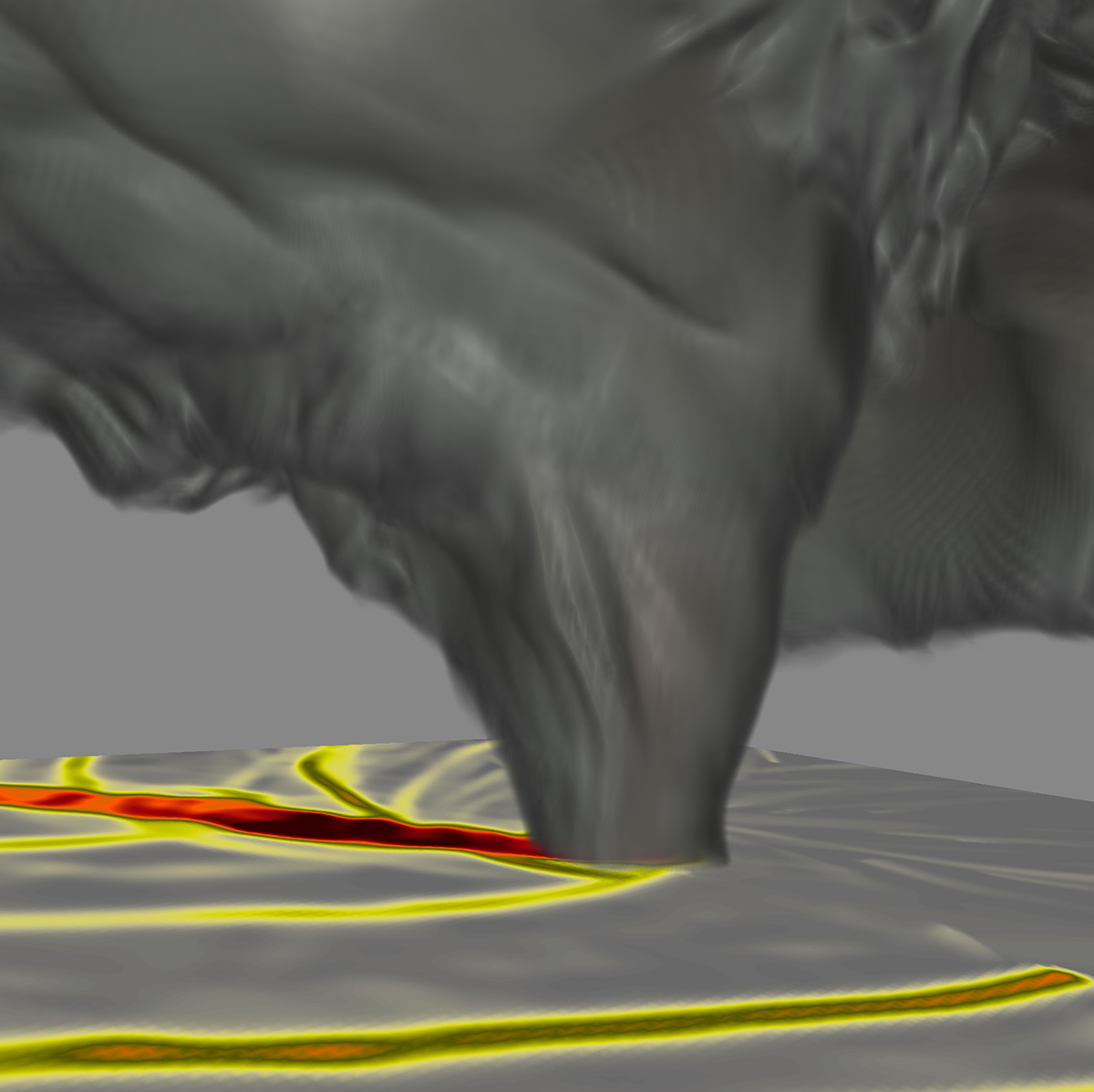
Our research team at SSEC focuses on conducting idealised simulations of tornado producing storms. Surprisingly little is understood about how the strongest tornadoes form and are maintained in supercell thunderstorms. Our group exploits the world’s most advanced supercomputing technology to accurately simulate supercell thunderstorms at resolutions where tornadoes, should they form, will be adequately resolved in both space and time.
Recently, we conducted breakthrough simulations on the National Science Foundation (NSF) sponsored Blue Waters supercomputer that has captured the entire life cycle of tornadoes in supercell thunderstorms in multiple environments where powerful, long-lived tornadoes were observed to occur. These simulations, while highly idealised and often requiring several days to compute, have shed important light on processes occurring within the storms that lead up to tornado formation. One particular feature we call the streamwise vorticity current (SVC) occurred in our simulations of supercell storms based upon two real events where devastating tornadoes developed. Supercomputer simulations have revealed that the SVC, formed within gradients of buoyancy in the storm’s thermodynamically cooled outflow, facilitates a significant drop in pressure in the storm’s updraft near the ground. This creates conditions favourable to the convergence of pre-existing weak vortices toward a central point that can result in tornado formation.
The identification of the SVC in simulation data by our group was one of the motivations behind the NSF sponsored Targeted Observations by Radars and UAS of Supercells (TORUS) field project, which aims to detect the SVC and other small-scale structures in real storms. TORUS and similar field programs use both radar and in situ technology (such as drones and other unmanned aerial systems) to obtain observations within the heart of these dangerous storms where tornadoes and attendant small-scale flows are found. Such field studies are crucial to both validate numerical simulations and also to improve numerical models, ensuring that they are providing physically realistic forecasts.
Breakthrough numerical data
The staggering amount of data produced by our team’s numerical simulations are motivating us to apply novel approaches toward model I/O and analysis, including the use of lossy floating-point compression.
Our compression strategy allows us to achieve the goal of performing post hoc analysis of full 3D data saved at sub-second time intervals in the vicinity of the tornado where the most intense winds are found.
Further, our team is exploring the use of automated analysis tools such as Entropy Field Decomposition to apply to both raw model data and simulated radar data to quickly identify spatiotemporal patterns associated with tornado formation and maintenance. It is one of our team’s primary goals to tease out patterns that could be identified on weather radar to help provide targeted, accurate warnings of tornadoes such that enough lead time is provided to get individuals and their families out of harm’s way in places where, each spring, these powerful storms fire up.
References
Orf, L., 2019: A Violently Tornadic Supercell Thunderstorm Simulation Spanning a Quarter-Trillion Grid Volumes: Computational Challenges, I/O Framework, and Visualizations of Tornadogenesis. Atmosphere, 10, 578.
Orf, L., R. Wilhelmson, B. Lee, C. Finley, and A. Houston, 2017: Evolution of a Long-Track Violent Tornado within a Simulated Supercell. Bull. Am. Meteorol. Soc., 98, 45–68.
Frank, L. R., V. L. Galinsky, L. Orf, and J. Wurman, 2017: Dynamic Multiscale Modes of Severe Storm Structure Detected in Mobile Doppler Radar Data by Entropy Field Decomposition. J. Atmos. Sci., 75, 709–730.
Acknowledgements: Leigh Orf is supported by the Space Science and Engineering Center at the University of Wisconsin and the National Science Foundation.
Please note: This is a commercial profile
Contributor Details

Editor's Recommended Articles
-
 Must Read >> Stormy weather ahead: Climate-related catastrophes
 -